


Parts of Yorkshire awoke to a smattering of snow, and it looks like we are set for some more over the weekend as we’ve started to feel the cold temperatures of winter approaching. A ‘wall of snow’ is set to cover the North including Yorkshire and the midlands.
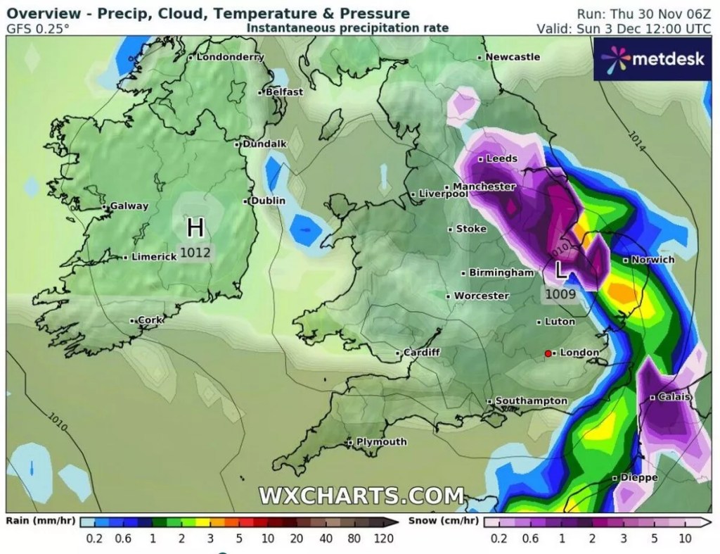
WXCharts show that snow will hit Liverpool and Manchester before arriving in Yorkshire on the Sunday morning. From 9am South, West and East Yorkshire can expect snow as well as parts of North Yorkshire, according to Yorkshire Live.
It is reported that around one to three centimetres of snow will fall an hour depending on where you are continuing into midday. Before becoming much drier in the evening.
Temepratures across the region will be around 0C to -1C across much of Yorkshire with areas of North Yorkshire reaching -2C in some areas.
Read More: 16 Of The Most Christmassy Afternoon Teas To Try In Yorkshire
It was reported that we’d see 11-days of cold weather last week and we seem to be in the midst of it at the minute.
According to The Met Office, we can expect: “Colder than average conditions overall continue to be most likely overall.
“Winds are likely to often be from the north, with a mixture of cold, quiet periods and some more showery episodes with rain, sleet and possibly hill snow. Any sleet and snow showers would be most likely to affect northern and eastern coastal districts.
“Colder weather could persist throughout, however towards the end of the period there is an increasing likelihood of an upward trend in temperatures as new areas of cloud and rain attempt to move in from the Atlantic.”
Read More: 4 Of The Most Spectacular Places To Enjoy Ice Skating This Christmas In Yorkshire


